F3 Environmental uses UAV drone technology to provide pre-, during and post-aerial images and footage for their clients to use in the planning, construction and ongoing maintenance of their projects.
The technology suits a myriad of conservation and environmental protection applications – offering quick, easy and cost-effective aerial imagery on demand in 5 simple steps.
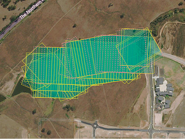
1 INITIAL SITE SURVEY
Get an aerial view of your job site, field or project faster than ever before. Factor3 utilise software that allows them to plan and automate their flights, flying 160 acres in less than 15 minutes.
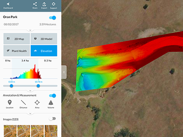
2 ACTIONABLE INFORMATION
The data taken from the flight can be used for multiple purposes – from simple but extremely accurate elevation measurements, through to whole-field insights.
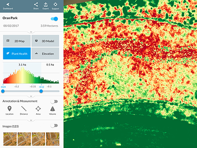
3 FIELD INTELLIGENCE
Spot variations and problem areas with NDVI, VARI and more. Examine crops, analyse plant health, and spot crop variability and stress for immediate investigation.
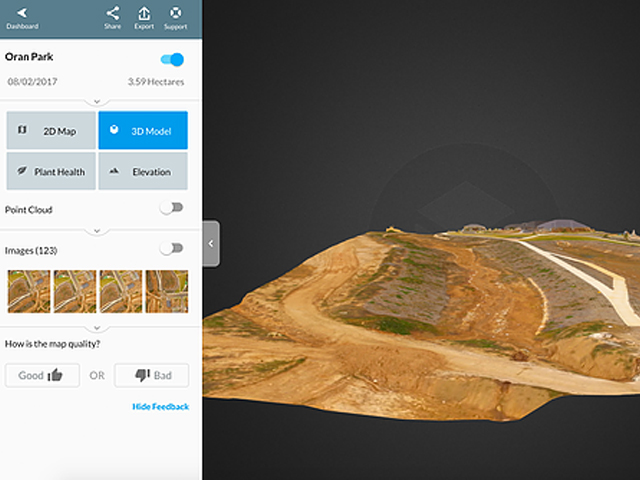
4 SITE DEVELOPMENT
Collect and calibrate site development, by measuring and exporting data at any point in the project life cycle. Evaluate site conditions with built-in measurement tools and create 3D models of sites.
5 PROJECT PROGRESS
Footage can be utilised to efficiently and effortlessly capture deliverables on your projects, and streamline decision making with visual context of site conditions.
F3 Environmental provides accurate, real-time mapping and data whenever you need it.