MELBOURNE PARKLANDS SET TO GROW
15 Nov 2017
Plans for a new urban parkland situated between Caulfield and Dandenong have been revealed by the Victorian Government that include extended cycling paths and a slew of recreational spaces.
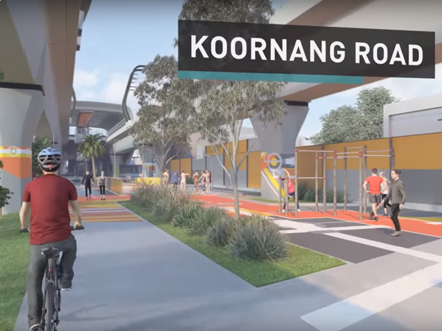
The Victorian Government plans to remove every single level crossing between Caulfield and Dandenong in order to create 11 MCG’s worth of new urban parkland. Key features of the plan include linear parkland, seven new recreational areas and a 17-kilometre cycling path that will extend from Monash University’s Caulfield Campus to the East Link Trail. 
Across the open space will be recreation facilities for all ages, including amenities for seniors, multipurpose sports courts, rock climbing and skate elements. Dog owners will have access to two fenced dog parks in Clayton and Noble Park, addressing a lack of off-leash facilities in Melbourne’s south-east.
“This area of Melbourne has the smallest amount of parkland in Victoria – we’re providing more space for locals and families to come together, exercise and play,” Minister for Transport Jacinta Allan said.
Plans for the 22.5 hectares worth of new open space were part of a government $1.6 billion initiative to remove the nine dangerous and congested level crossings between Caulfield and Dandenong and create an elevated railway line between Cranbourne and Pakenham. 
“By removing the most dangerous and congested level crossings, we are making our communities safer – and by providing more open space we’re making them a better place to live,” claims Allan.
“Some of Melbourne’s most vibrant precincts are located around elevated rail and this open space will help invigorate shopping and hospitality along the corridor.”