HIGHWAY TO HEAVEN
18 Apr 2019
A project proposed by BIG sees the three-tier Queens Expressway in Brooklyn, New York, transformed into a beautiful waterfront park and greenspace. The scheme outlines plans for the outdated highway to be relocated underground, with the tiered roads turned into multi-purpose park spaces that provide a green haven for the community.
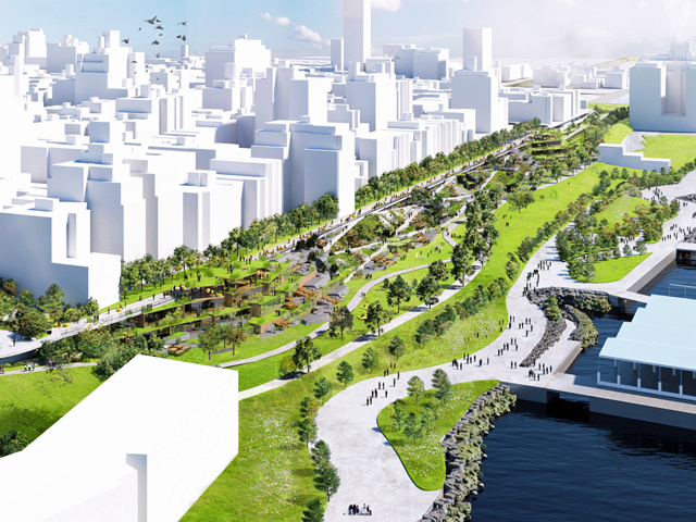
The three-tier highway is set to undergo much-needed repairs that fail to accommodate for the barrier that would be created by the new infrastructure that will separate the city from the waterfront. Bjarke Ingels Group’s proposal addresses this issue and outlines a greenspace that can accommodate a subterranean highway beneath a thriving public greenspace, connecting the city with the water. The scheme proposes a 50,000 square-metre greenspace to as an addition to the elevated expressway that passes along the edge of a residential area, while also repairing the site. 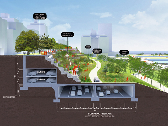
"The result is a condition more reminiscent of Brooklyn Heights historical conditions – where city and river interlaced seamlessly, prior to construction of the highway," said a project description by the firm. BIG, which has a New York office nearby, added that it was "inspired by the opportunity to work in our own backyard".
The first component of the proposal is the construction of a roadway along Furman Street and Brooklyn Bridge Park, which will hold a simplistic deck structure that provides a platform for installing parkland along the corridor. This will, therefore, connect the Brooklyn Heights and Brooklyn Bridge Park with a patchwork of intersecting ramps, greenery and park spaces. 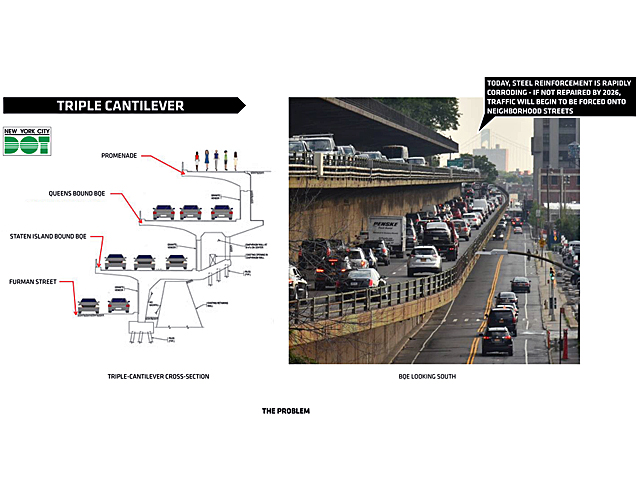
"The deck structure extends south to Atlantic Avenue – where it creates a new crossing and urban nexus, and the beginnings of a linear park which could eventually connect Dumbo to Red Hook," said the architect’s description.
Access to the park will be accommodated via a parkway, while additional space will be left for the nearby light-rail line to be extended.
The structural approach of the park creates a cheaper alternative for the highway’s reconstruction will also providing an option for much-needed open greenspace. The project alludes to the history of the Brooklyn Heights park, where the waterfront was originally integrated into the highway. 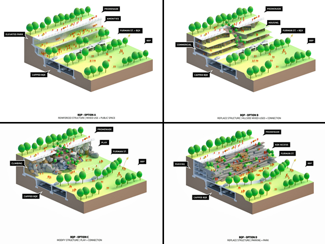
The expressway was built back in the 1950s and links Brooklyn and Queens and interlaces with Manhattan accesses. The upper levels allow for vehicles to pass into the main area of the city and beyond. The proposal sees a six-lane highway constructed underground with three lanes dedicated for northbound traffic and three for southbound.
The sloped design of the park will connect the current top tier level of the existence expressway to the waterfront. Greenspaces and pedestrian paths would sit along the top with four acres of parkland spanning across the linear park. To take advantage of the sloped site, BIG had developed many options that include a rock-climbing wall, terraced gardens, and retail and residential precincts. 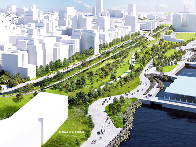
The park will connect to the existing Brooklyn Bridge Park, which also stretches out along the waterfront and includes a winding path that connects multiple neighbourhoods.
With four alternative plans proposed, each version sees the expressway moved underground alongside subterranean parking.
The initial plan from the Department of Transportation (DoT) for the area saw the expressway replaced with a temporary elevated roadbed that would close the area for several years. BIG’s plan is slated to be quicker and cheaper, with the motto for the plan being “build once, not twice”.
"The simple structural approach, and one-time construction of the new roadway, will create a more feasible and less costly solution for reconstruction of the BQE, while delivering far more benefits to the community," BIG said. 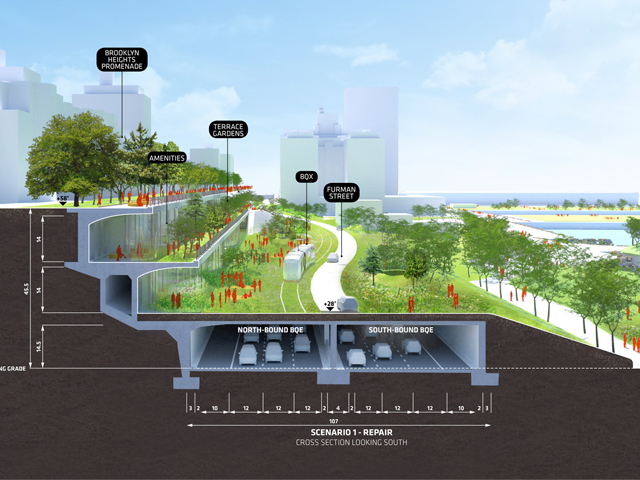
Images © Bjarke Ingels Group


MORE NEWS

HARNESSING THE POWER OF DESIGN TO TRANSFORM CITIES

NEW 750 STUDENT PRIMARY SCHOOL ANNOUNCED FOR FRASERS PROPERTY’S MIDTOWN MACPARK

AT THE STARTING LINE

MASTERPLAN FOR INCLUSIVE, CLIMATE-RESILIENT COMMUNITY PARK IN LISMORE

LANDSCAPE INDUSTRY PODCAST - THE FRONT GARDEN